G Line
Facts
- Length: 11.2 miles
- Vehicle Type: Electric commuter rail
- Stations: 8
- Parking: 2,300 (opening day); 2,890 (projected by 2030)
- Frequency of Service: 30 min
At a Glance
- The Gold Line, officially referred to as the G Line, is part of RTD’s 2004 voter-approved FasTracks plan to expand transit across the Denver metro region.
- The 11.2-mile electric commuter rail line connects Denver’s Union Station to Wheat Ridge, passing through northwest Denver, Adams County and Arvada.
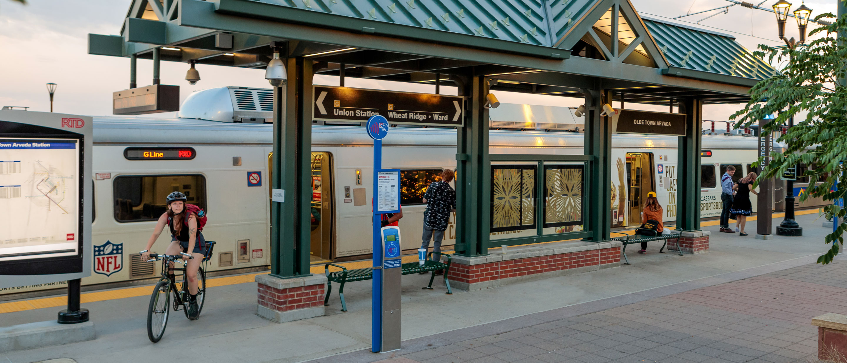
- The G Line features seven stations: 41st•Fox, Pecos Junction, Clear Creek•Federal, 60th & Sheridan•Arvada Gold Strike, Olde Town Arvada, Arvada Ridge, and Wheat Ridge•Ward.
- The line is part of the larger Eagle P3 project that is also building the A Line and the first segment of the B Line.
Project Overview
- 2006: RTD FasTracks began a transit-alternatives study that resulted in an Environmental Impact Statement (EIS).
- 2007: The Federal Transit Administration (FTA) selected the Gold and East Rail lines for its public-private partnership pilot program, giving birth to the Eagle P3 project.
- 2009: RTD FasTracks released a final EIS; received an FTA Record of Decision, signaling the completion of the environmental process; and released a request for proposals to seek a private partner to design, build, finance, operate and maintain the Gold and East rail lines.
- 2010: RTD FasTracks selected Denver Transit Partners as its Eagle P3 contractor and concessionaire under a 34-year contract.
- 2011: Eagle P3 received a $1.03 billion Full Funding Grant Agreement from the FTA, the largest awarded by the Obama administration at the time; construction began.
- 2019: Line opens to the public as the G Line on April 26.
Ridership
Boardings regularly fluctuate due to many factors, including economic conditions, seasonal demands, remote work trends, service disruptions, large events, and activities. A regularly updated overview of RTD's ridership is available online in the Board Briefing Documents.
- 2024 Total Ridership: 1,068,000
- 2023 Total Ridership: 1,085,000
- 2022 Total Ridership: 1,018,000